The precipitation has already changed over to rain for the southern half of southeast Michigan and the changeover will continue to move its way north throughout the morning. The NWS has already removed the winter weather advisory for the counties closer to the Ohio border and will likely do the same for other counties as the morning progresses. South of I-69 will see mostly rain during the day until later this evening when temperatures are expected to drop back below 32°F. North of I-69 will stay closer to 32°F during the day and will likely change back over to snow earlier, giving the possibility for accumulating snow.
Below are the current surface map and radar images. You can see on the surface map that the cold front has already made its way into western portions of Michigan. The cold front will move through during the afternoon, ushering in cold air behind it.

Image courtesy of HPC
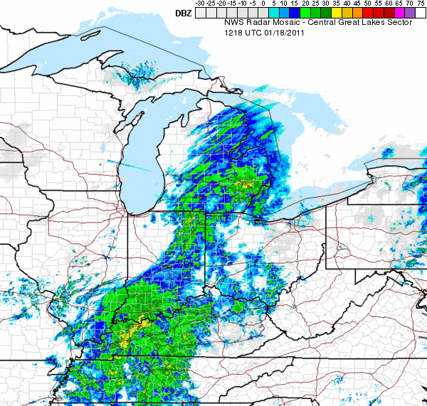
Image courtesy of NWS
My main concern for the rest of the day is the conditions of the roads once the cold front passes through. The temperatures behind the cold front are very cold which will freeze the roads covered with water. This can make for very slick driving conditions. The image below shows the current temperatures for the Great Lakes region. You can see the temperature difference on each side of the cold front.

Image courtesy of SPC
No comments:
Post a Comment