There is a blizzard warning in effect for southeast Michigan this evening until Wednesday. The forecasted accumulation is generally the same as earlier this morning, but the NWS Detroit branch has made some adjustments.
The most important adjustment is that they expect the heaviest accumulation to be further north, generally from I69 north to the Saginaw Valley. This is because the surface low is expected to track closer to Michigan before it transfers its energy to another surface low in the east. This more northern track means three things; the first is there will be a chance for sleet to mix in with the snow for a few hours for the counties near the Michigan/Ohio border. If this does occur, accumulations in that area will likely be a few inches less, depending on the duration of the sleet. The second issue with a more northern track is that what is known as a “dry slot” will have a better chance of brushing the southern counties, thus lowering totals. I have indicated the current location of the dry slot on the water vapor image below.

Image courtesy of RAP
The third issue is the area of strongest snow will also be to the north. The image below represents the current radar. The black circle represents the snow that is approaching us at this time. Near the back of it is an area of heavy snow that will possibly stay only in the northern half of southeast Michigan (as the dry slot approaches the southern half), resulting in higher accumulations to the north. The red arrow represents the general track of surface low during the evening.
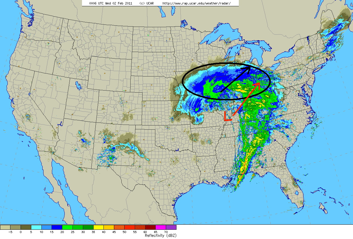
Image courtesy of RAP
There is good model agreement that this is what will happen overnight into Wednesday morning, but if the low doesn’t end up tracking further north then you can expect everything to be shifted to the south causing the sleet and dry slot to stay at or below the border, and the heavier snow bands to stay in the Oakland, Macomb, and Wayne county area.
Either way, this is going to be an impressive storm with generally 8-12 inches expected south of I69 and 10-15 inches expected from I69 to the Saginaw Valley. If you’re a fan of snowstorms, enjoy the storm since storms of this intensity only come around once every several years. If you’re not a fan of snowstorms, then it’s probably best to stay inside for a couple days.
Enjoy!
No comments:
Post a Comment